Tourism

Sarankot

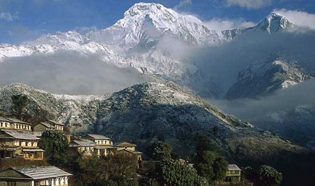
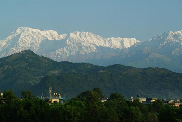
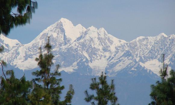
Country: Nepal Zone: Gandaki District: Kaski Area code: 061 Coordinates: 28°14’30”N 83°58’0”E Sarankot is located on Gandaki Zone of Nepal. It is situated in Kaski District. It is located in five kilometer away from the Lakeside of Pokhara. Sarangkot Mountain is at an altitude of 1600 meter. Sarangkot is one of the most popular Tourist destinations from where people can …

Read More »

Rupa Tal

Country: Nepal Location: Kaski Lake Type: Fresh Water Surface Area: 1.35 sq km Maximum Depth: 6 m Average Depth: 3m Catchment Area: 30 sq km Coordinates: 28°8’55”N 84°6’40”E Pokhara is beautiful city which is located 200 Km west of Kathmandu Valley. Pokhara, often called as a piece of heaven, is a beautiful city of Nepal blessed by Nature. This is …

Read More »

Pokhara

Country: Nepal Zone: Gandaki Zone District:  Kaski Area: 464.24 sq km Water: 4.4 sq km Coordinates: 28°15’50”N 83°58’20”E Pokhara is the famous Tourist destination of Nepal. It is seek of Natural Beauty and adventure. It is located 200 km west of the capital Kathmandu. It occupy an area of 464.24sq km. it is nine times larger than Kathmandu. Pokhara is …

Read More »

Pisang

Country: Nepal Zone: Gandaki District: Manang Elevation: 3250 m Coordinates: 28.61673°N 84.14991°E Pisang is situated in the Manang District of Nepal. It lies in the Gandaki Zone. It is considered as one of the easier climbing peaks among the Trekking Peaks in Annapurna Region of Nepal. The Pisang Peak has majestically stood up above the village of Pisang and has …

Read More »

Phulchowki Hill

Country: Nepal Situated: Godavari, Kathmandu Height: 1525 m Coordinates: 27°36’0”N 85°24’0”E Phulchoki Hil is situated South-East part of Kathmandu valley. Phulchowki Hill is 20 km Far from Kathmandu City. Phulchoki is highest view point near from Kathmandu valley. Walking through ascending trail of jungle offers one to see several residential and migratory birds as well as scenic views of Nepalese …

Read More »

Pharping

Location: Nepal District: Bagmati Coordinates: 27°36’0”N 85°16’0”E The Town of Pharping is said to have been built and expanded to the present size during the reign of King Bhimarjun in 797AD. Pharping is also believed to get its name from the epithet of Shesh Narayan Phannathingu. This is one of the four Narayan Temples that mark the four corners of …

Read More »

Pathibhara Temple

Country: Nepal District: Taplejung Elevation: 3794m Primary Deity: Pathibhara Devi Architectural Styles: Pagoda Other Name: Mukkumlung Coordinates: 27°25’46”N 87°46’3.8”E Pathibhara Temple is located on the Hill of Taplejung. It is 19.4 North East from Phungling Municipality. It is an elevation of 3794m. It is considered as one of the Holy place of Limbu people. The Temple is the most significant …

Read More »

Patan Durbar Square

Country: Nepal Zone: Bagmati District: Lalitpur Total area: 15.43 sq km Coordinates: 27.6727°N 85.3253°E Patan is the best known for its Artistic Heritage. It is probably, the oldest Buddhist City in the world. The city is situated on a plateau across Bagmati River. Another name of Patan is Lalitpur. City is surrounded by four Stupas as four corners of Patan. …

Read More »

Pashupatinath Temple

Country: Nepal State: Bagmati Zone District: Kathmandu Architectural style: Pagoda Importance: Shivaratri, Teej, Bala Festivals: Chaturdashi Coordinates: 27°42’35”N 85°20’55”E Pashupatinath Temple was erected by Lichhavi King Shupuspa Deva. Pashupatnath Temple is Located on the bank of Bagmati River. It is 5 km North- East of Kathmandu Valley. The Temple is considered one of the sacred Temple of Hindu faith. The …

Read More »

Parsa National Park

Location: Nepal Area: 637.37 sq km Established: 1984 Governing Body: Ministry of Forests and Soil Conservation Coordinates: 27°28’N 84°20’E Parsha National Park was established in 1984 A.D. it is a protected area in the Inner Terai Lowlands which covers an area of 637.37 square kilometer. It lies in the Parsa, Makwanpur and Bara Districts. It is the Largest Wildlife Reserve …

Read More »