Location: Nepal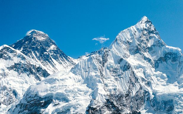
District: Solukhumbu
Zone: Sagarmatha
Elevation: 8848 metres
Coordinates: 27°59’17”N 86°55’31”E
Mount Everest lies between Nepal and Tibet. It is Himalaya Mountain Range which stretches 1500 miles from Northeastern Pakistan to Bhutan. There are over thirty mountains higher than 25000 feet of the fourteen 8000 m peaks. In 1841, a Britist surveyor named sir George Everest identified the location of Mountain. Fifteen years later using trigonometry and measurements from 12 different survey station around the mountain ‘peak XV’ was surveyed as the world’s highest mountain at 29002 feet. In 1865 it was re named Mt Everest and also called as Sagarmatha by Nepalese and Chomolungma in Tibet. In 1955, the height was adjusted to 29,028. On May 5, 1999 a national geographic society expedition put GPS receiver on the summit. But using a second trimble GPS receiver at the 26,000 south pol they make an extremely accurate measurement by running the two receivers simultaneously. The new altitude was 29,035 feet. However the Nepalese still use 29,028 as the official altitude.
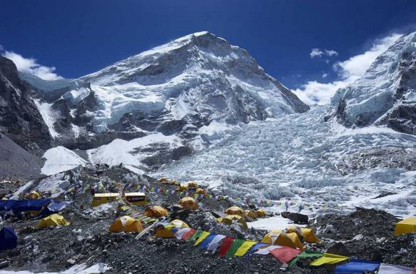
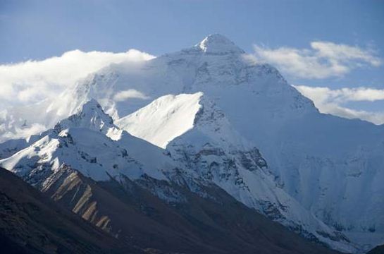 Mt Everest is the highest peak of the world of 8848m, which offers the view of several 8000 m peaks. Everest Base Camp is one of the most popular treeking routes in Himalayas. The two main routes became standardized. South base camp is at an altitude of 5364 m (28 0’26”N 86 51’34”E) and north base camp in Tibet at 5150 m (288’29”N8651’5”E). These camps are rudimentary campsites on Mount Everest that are used by mountain climbers. The visitors get chance to explore the Sherpa culture, hospitality and social lifestyle that are marvelous aspects of this trek. The bustle town of Sherpa people Namche Bazaar and Khumjung are densely populated Sherpa valleys. The monasteries Chhortens and mani walls are common scenery along the trail of Everest Base Camp. The best seasons of the Everest Base Camp Trek are march to may and September to November.
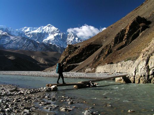
The Everest Base Camp Trek on the south side is one of the most popular trekking routes in the Himalayas. Trekkers usually fly from Kathmandu to Lukla. It is visited by thousands of trekkers each year. From Lukla, climbers trek upward to the Sherpa capital of Namche Bazaar. It is about 3440m following the valley of Dudh Koshi River. A visit to north base camp currently requires a permit from the Chinese Government. The north base camp is accessed by vehicle through a 100 m road branching to the south from the friendship highway near Shelkar. The Tourist Base Camp is located about halfway between Rongbuk Monastery. The actual climbers Base camp is at the foot of Rongbuk Glacier.
 Trekking to Everest Base Camp provides an opportunity to embark on an epic journey that sir Edmund Hillary and Tensing Norgay Sherpa set off to in 1953. Apart from amazing valleys, forests, villages, foot bridges, rivers passes glaciers and waterfalls gives an amazing view. It is perpectually surrounded by the mightiest and most majestic peaks that this planet has to offer. It is also an opportunity to see the people and culture of the legendary sherpas who are known to the world as born mountain climbers. One gets opportunity to explore the heritage listed Sagarmatha National Park, which is home to a variety of wildlife, deer, Himalayan thar and birds including the Himalayan griffon vulture, Tibetan snow cock, spotted Rosefinch and colourful Danfe pheasant, the National birds of Nepal.